Community Bike Ride Around the San Diego Bay on August 26, 2012


Route / Map

Click to go to Interactive Route Map


Route Description

The 25-mile non-timed, non-competitive ride starts and finishes at Embarcadero Marina Park South is located at the foot of Marina Park Way on the San Diego Bay. Take Harbor Drive north to Park Blvd and turn right. Follow Park Blvd around behind the Convention Center to Park entrance and start line. Click here for a map.  From Embarcadero Marina Park South, riders will cross over the San Diego-Coronado Bay Bridge and travel the Bayshore Bikeway through the five cities surrounding the San Diego Bay before returning to the Park.
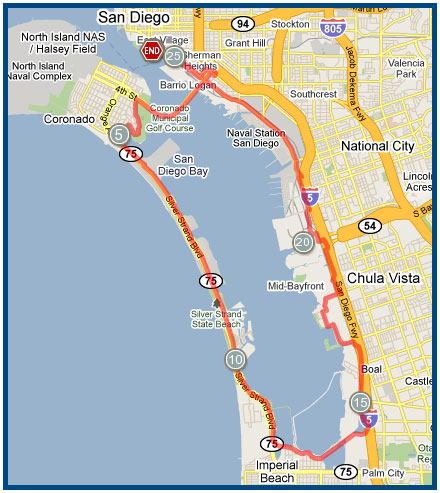
We encourage all riders to bring water bottles with them on the ride however, there are 3 optional Rest Stops offering water and refreshments along the course.

#1 - Glorietta Bay Park/Coronado (approx. mile 5):
Located along Silver Strand Bike Path at Rendova Road. Please turn left at Rendova to enter Park.

#2 - Imperial Beach - Bayshore Bikeway at 13th Street.  This is the entrance to the newly opened extension of the Bikeway along the old railroad right of way .  This extension allows riders to avoid the high traffic streets of Imperial Beach such as Plam Avenue.

#3 - Pepper Park/National City (approx.mile 21)
Located on Tidelands Avenue


Click for a route map of the Bayshore Bikeway

Click for an album of photographs taken along the ride route